|
|
view larger map (with Street Views)
|
Google Street View has changed the way that people interact with online maps and finding directions.
Controversial images as well as strange photographic glitches have only heightened the public's fascination with this interactive panoramic mapping system.
The now-infamous Google Street View van has recently visited White Lake and the surrounding areas' main streets. Drag the little yellow icon stickman from the left of a google map of White Lake, and drop it where ever the road has a blue outline, and 'visit' White Lake.
|
Microsoft also has an excellent BING maps of this area, click here and choose "Bird's Eye", then zoom in.
Driving Directions
 |
From Downtown Ottawa to White Lake Village Beach
(approx 60 minutes)
-travel West on the 417 (Queensway) past Kanata to ARNPRIOR (avoid Highway 7 to Toronto)
-just STAY on the 417, drive to Arnprior (about 20 min.)
-take the "White Lake Road" exit & turn Left on White Lake Road (also called Highway #2) (there are gas stations, Tim's & grocery stores here if you require anything)
-continue on White Lake Road until you reach White Lake Village (about 20 min.), speed limit goes down to 50 km
-Turn right at the Stop Sign (at a little gas station/beer/lcbo/bait and big church)
-Just follow that road (Burnstown Rd, Hwy #52) for about 2 minutes, and if you are instead headed to the South end of the Lake, follow the appropriate signs.
|
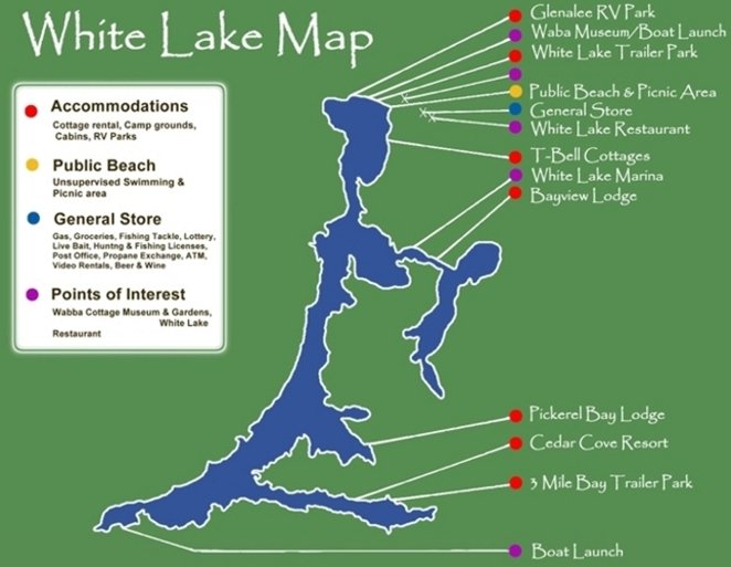
Lake Maps
|
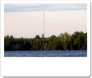
White Lake is very large with a labyrinth of similar looking bays and islands (and a few marked submerged rocks!). There is a tall communications tower that you should take note of when you head out by motor boat, as it will assist you on figuring out where you are later in the day.
Plan to spend several hours (and a tank of gas) if you plan to explore from one end of the lake to the other.
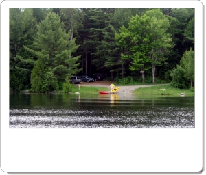
If kayaking or canoeing there are vast areas with little or no development for a tranquil paddle amongst nature. And as the lake is so large, it will seem like there are very few other boaters around as well.
Boat Launching Areas
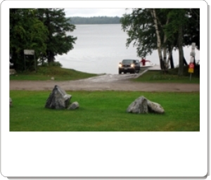
Waba Cottage & Gardens: A quick and easy launching point. It is a very direct and fast drive from all points. There are no services on-site (bait, fuel, etc), but if you have your own boat, trailer and want to launch and park for a small fee, this is your best choice. As well you can take a moment and visit the historic Waba cottages and gardens, and there is a modern bathroom facility (in the old general store building on the side during museum hours). If you require full services, you can launch from here and then stop by one of the resorts or marina (see the maps for directions), or simply launch from the resort or marina instead (fees apply).
 Map This Map This
South End of the Lake: There is also a municipal boat launch at the far South end of the Lake if you are traveling to White Lake from that direction and wish to launch there.
Map This

|
|
It may be of interest, however, to note that the first systematic aerial photography of the area was shot in 1926.
And more impressive signs of changed times are evident if we follow the camera as the homeward bound pilot swings over the Madawaska or the Ottawa and we see the booms enclosing thousands of logs on their way to Hull, a reminder that the rivers were still a highway of commerce in the last century. |
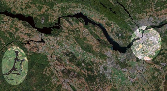
Relative Distance from White Lake to Downtown Ottawa
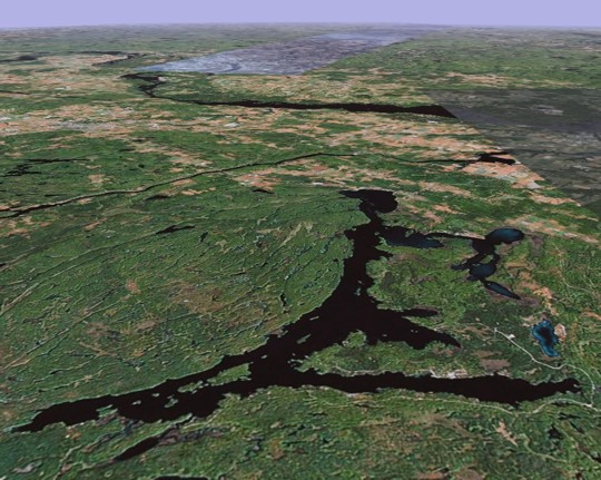
White Lake, looking North towards the Ottawa River, showing the horizon

White Lake
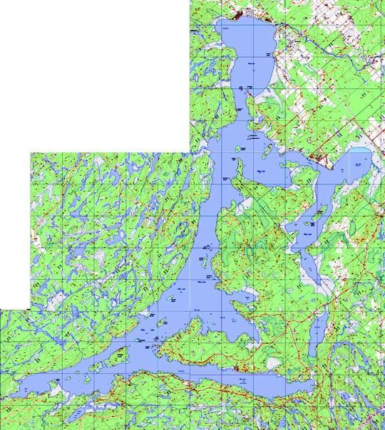
White Lake
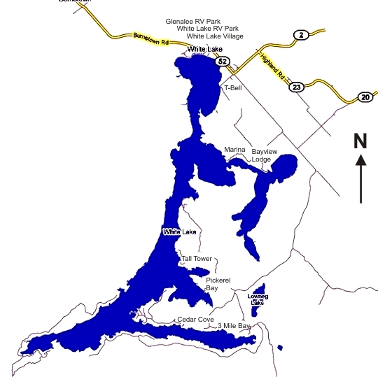
White Lake, roads & sites, simplified
Physical Info:
length: 16.09 Km / 10 miles
surface area: 22.7 million square meters / 5,608 acres
perimeter: 97.8 Km / 60.8 miles
|
Did you find what you were looking for?
If you've found this completely FREE information useful & time-saving, let us know.
(If you didn't find what you were looking for, please click here and let us know... )
Comments:
The web site is well done. It is easy to find the information required. You have integrated many beautiful pictures.
Enticing information for vacation planning. White Lake residents should be proud!
-Ottawa
Have had a cottage on the lake for some 20 years... can only access it by boat. Used the ice on and off dates to gauge when I might be able to access the cottage. I am sure a lot of others looked forward to seeing freeze/thaw dates.
-Seaway Region
My name is TF and I grew up coming to White Lake every summer for two weeks hanging out with DT.
This is a great site, takes me back. Love the pictures.
-Innisfil, Ontario
I have been fishing White lake for a number of years. Some of the best bass fishing I have ever seen and
a very beautiful lake. I enjoy visiting every summer.
-Lords Valley, Pennsylvania USA
I was amaze at this site, didn't realize that White Lake had such a nice site. This is great for people coming from outside. We have a place at Bayview Lodge and I thought I would look at this site, it is very well done indeed.
I hope you keep it up to date.
-Ottawa
|
Large Printed Maps
|
Are available from sale at the White Lake Village General Store for a small fee. Small photocopied maps are usually offered when renting a motor boat.
To view online maps, and order print copies
(if you are so inclined):
Natural Resources Information Centre
PO Box 7000
Peterborough, ON K9J 8M5
1-800-667-1940
Tel: 705-755-2001
Fax: 705-755-1677
https://www.ontario.ca/page/topographic-maps |
|
|
 |